Sunday, August 23, 2020

Get Away From It All at Canjilon Lakes


Tucked away deep in the heart of Hispanic northern New Mexico is one of the state’s more secluded high country hideaways.

Canjilon Lakes boasts several small ponds stocked with rainbow and cutthroat trout and is surrounded by lush mountain scenery and plenty of camp sites.

The lakes have long held a reputation for being a locals-only recreation area due to its remote location and cultural heritage.

Reports of vehicle break-ins, campground confrontations and hostile looks are bandied about by some in the angling community.

A vintage camper in one of the many U.S. Forest Service campsites at Canjilon Lakes.
But when it comes to fishing you’ve got to wonder if reports like these are real or just fabrications told by coy anglers trying to protect a favored fishing hole.

We ventured north to find out for ourselves on the Thursday before the start of the long Fourth of July holiday weekend.

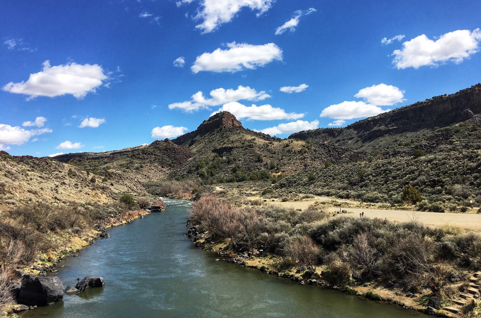
The pleasant drive north on U.S. 84 took us through O’Keefe country past the striking red buttes overlooking Abiquiu Lake and the cathedral-like overhang at Echo Amphitheatre.

Echo Amphitheatre. Print available at www.karlmoffatt.pixels.com.
The turnoff to Canjilon comes before reaching Tierra Amarilla, the Rio Arriba County seat and site of the infamous 1967 court house raid by Chicano land grant activists.

Sign on private land outside Tierra Amarilla. Photo courtesy of Wikimedia Commons.
The raid and Canjilon’s association with it contribute to the lore of the lakes. For greater insight check out Russell Contreras of the Associated Press’ account of the historic incident at https://apnews.com/f61be51c282644b39c3347e89ec39cba.

Passing through the hamlet of Canjilon one can sense how this was once a thriving settlement where farming, ranching and living off the land was a way of life.

The U.S. Forest Service maintains a ranger station here where the controversial history of the land grants influences how the surrounding public lands are managed.

Photo courtesy of Russell Contreras.
Check out the following academic studies for more detailed information about the community, culture and history.

See: https://www.fs.fed.us/rm/pubs/rmrs_p007/rmrs_p007_035_038.pdf and
https://pdfs.semanticscholar.org/9a02/3c8a1565b779a4f38969be9f9cccc4c51f5c.pdf?_ga=2.110956293.1624900775.1597697415-521613099.1597697415.

On the road to the lakes we pass piles of downed trees stacked by the roadside and littering the surrounding ground. These are some of the hundreds of trees that fell victim to insect infestation and drought that caused many to suddenly come down, forcing the Forest Service to close the area to the public for several years.


With many of the trees now cleared the area is open again and folks are able to find some relief from the daily grind of the Coronavirus Pandemic.

During our visit we found plenty of people at the upper two lakes and campground but didn’t see anyone throwing us “heƱos” (dirty looks). And everyone we met was friendly and helpful, too.

The upper lake at Canjilon Lakes. 
There were no anglers at the lower pond we passed on our way in so we returned there to get the place to ourselves. We spread out around the shoreline and found plenty of eager trout taking our Pistol Petes trolled below a bubble or rising to a grasshopper fly riding on the surface.


While fishing we watched as a steady flow of traffic rolled by headed for the upper lakes and campground. But we remained the sole anglers on the lower pond and enjoyed a very relaxing visit.

The only drama we encountered was on our return when we elected to take a forest service road over to El Rito rather than go back through Canjilon. We could have sworn the sign at the intersection said 15 miles, turns out it was more than twice that over a rough dirt road. We saw a lot of back country, very few other people and gained a much greater appreciation for the area’s vast remoteness.

A rare paved road leads to Canjilon Lakes.
Canjilon Lakes turned out to be a great place to visit and enjoy some good fishing, sweet scenery and the opportunity to learn more about the area’s interesting history.

As for it’s bad reputation?

Maybe that really is nothing more then a few shifty anglers trying to keep this jewel of a fishing spot under wraps.

Wednesday, June 03, 2020

Cabresto Lake a Great High Country Hideaway


Wanna get away from it all?

Try putting a couple miles of bad road behind you while climbing into the high country to stalk brook trout at a remote mountain lake.

Cabresto Lake above Questa in scenic northern New Mexico is hard to reach but well worth the effort.

The 15-acre lake at 9,500 feet is surrounded by towering mountaintops and provides a peaceful place to escape life’s challenges for a day.

With very limited camping and two miles of narrow, twisty, rocky road to negotiate, the lake sees far fewer visitors than its popular cousin in the valley below, Eagle Rock Lake.


But those willing to make the trip are greeted by a postcard picture scene amid the cool, lofty pines found on the outskirts of the nearby Latir Peak Wilderness.

Self-sustaining populations of colorful brook and cutthroat trout await anglers in the clear, deep waters of the impounded lake.


The steep slopes around the lake can make getting around difficult but like the rest of the venture here, it’s worth the effort.

Anglers equipped with a spin casting rig armed with a Pistol Pete, wooley booger or bead-head below a bubble can be very effective here. But casting a fly line to rising fish could be troublesome for some due to the cramped confines of the shoreline. The creek above and below the lake is far more suited for fly-fishing.

And while anglers love the place and account for most visits, many backpackers and day trippers use the trailhead to hike into the aspen groves and alpine meadows found in the surrounding wilderness.

The altitude here can leave some flatlanders breathless so taking a few days to acclimatize before visiting might be necessary.


A lone vault toilet stands in the lakeside parking lot and visitors can help keep it clean and usable by bringing one’s own toiletries and cleaning supplies.

There are a few hardscrabble, primitive campsites to be found near the parking lot and a few others are carved out on the cliffside overlooking over the dam and creek below.


 Those hardy enough to spend a night here should be extra mindful of keeping a clean campsite to avoid attracting wildlife. The surrounding wilderness is home to lots of bears, mountain lions, coyotes, skunks and raccoons. Pack out your trash to help keep it clean and usable for others.

Just getting to Questa is part of the journey with travelers apt to come across plenty of great scenery along the way.

Those heading north to Questa on N.M. 68 through the Rio Grande Gorge between Espanola and Taos will find many tempting spots to stop along the river.  


A great side trip along the way includes jumping off N.M. 68 at Pilar and following the river to the Taos Junction Bridge

The Rio Grande as seen from the Taos Junction Bridge.
After crossing the bridge the road turns to dirt and climbs to the top of the canyon wall. Low slung, passenger cars navigate this road all the time so don’t be afraid to continue. At the top the road returns to asphalt and then splits with one branch continuing to head north along the Rio Grande Gorge. Along the way there are plenty of pull-offs that lead down to the canyon’s edge where the views can be spectacular. Those lucky enough may spy a group of bighorn sheep climbing the canyon walls or resting among the bushes on top. 


Travelers continue down the road to its intersection with U.S. 64 where they can then get back to the other side of the river by crossing the Rio Grande Gorge bridge. 


Visitors can park at the well-kept rest area here and walk out onto the bridge for even more spectacular scenery before continuing on to Questa. Stepping out onto the 600-foot high bridge and looking over the railing at the river far below is not for the faint of heart. This side trip can be made either going to or coming back from Questa. Consult a map for more details.

The Rio Grande, 600 feet below as seen from the Gorge Bridge.

Sunday, April 19, 2020

Much of New Mexico's Outdoors Under Coronavirus Quarantine


Much of New Mexico’s great outdoors including many public campgrounds remain closed due to the Coronavirus Crisis and non-residents are banned from using state parks.

Governor Michelle Lujan Grisham has ordered schools and many businesses closed and the public to stay home during the crisis.

But she has acknowledged folks still need to get outdoors to exercise and asks they continue social distancing and other precautions while doing so.

 “You can go outside but you must do it cautiously and there are best practices,” Gov. Lujan Grisham stated in a recent news release.  “Avoid crowded trailheads and parking lots, and don’t carpool with people outside your family unit.”

Some guidelines to follow while venturing outdoors include:

  • Stay close to home. Try to limit outdoor recreation to your immediate neighborhood. When traveling avoid other people, limit stops at open businesses and practice preventative measures. Wear a facemask and wash hands often.

  • Be cool. Avoid risky outdoor recreational activities to avoid getting hurt and needing rescue. Take a leisurely hike instead of going rock climbing or mountain biking and give our emergency responders, law enforcement and health care workers a break.

  • Check for closures. Visit the various land management agencies’ websites before venturing out to public lands. Most open spaces are closed right now to protect the public and agency staff. Visit the state’s Outdoor Recreation Division website at www.nmoutside.com for links and lists of closures.

  • Avoid others. Try to limit your recreation to off hours or days to avoid others. Stay away from popular trailheads that are typically crowded and stay closer to home. Get some exercise but stay safe.

Outdoor enthusiasts will find most of the lands managed by the federal Bureau of Land Management (BLM) and the National Forest Service (NFS) are still open to the public but some campgrounds, trail heads and roads might be closed. A limited number of state parks have been opened as of May 1 but out-of-state visitors are banned from using them. Visit http://www.emnrd.state.nm.us/SPD/ for more information. Do your homework before venturing out. Campers are advised that campfires are currently prohibited due to fire danger.

When venturing out make sure to wash hands often, wear a facemask and stay at least six feet away from others to minimize possible exposure to the Coronavirus. Out-of-state visitors are required to quarantine in place for two weeks when visiting New Mexico. 

In the meantime visit our library to read great stories and view fabulous pictures of many of New Mexico’s best outdoor recreational activities to better prepared to enjoy them when the crisis is over.


Wednesday, February 12, 2020

Escape Winter's Grip with a Pancho Villa State Park Roadtrip

Statute of Pancho Villa in the Mexican border town of Palomas.
When winter has its icy grip on northern New Mexico it’s time to make a beeline for the border.

A visit to Pancho Villa State Park in the warm, sunny border town of Columbus makes for a great winter get away.

The park features plenty of roomy campsites and clean restrooms and a remarkable museum dedicated to the real Mexican invasion of the United States back in 1916.

Pancho Villa State Park Museum.
During the early morning hours of that historic day about 500 of revolutionary leader Pancho Villa’s troops snuck across the U.S. border and attacked the sleepy town and Army garrison stationed at Columbus New Mexico.

Historical accounts speculate as to the attack’s purpose ranging from Villa’s need for military and other supplies or in revenge for American meddling in Mexico’s revolution.

The attack was repulsed though leaving many of the invaders and a few villagers and some soldiers dead. The U.S. Army then launched its own invasion into Mexico in search of Villa but the Army expedition returned home empty-handed after a year.

The story is better told in viewing the documentary film and reading the interpretive displays within the park’s museum. Visitors will find a full size replica of an early model biplane hanging in the spacious museum, a restored military truck and display cases featuring firearms, uniforms and other items from the era.

Display in the Pancho Villa State Park museum.
Outside the museum visitors will find one of the Army’s armored trucks on display and more interpretive signs along trails around the park which was once known as Camp Furlong.

The park is popular with travelers known locally as “snowbirds” and is reported to be busiest during the winter months. Unfortunately several telephone calls to park management seeking further information about the park and its operations were not returned. 

During a recent visit plenty of spaces with hookups were still available even on a Friday afternoon. A $10 tent site came with a covered shelter, picnic table and fire ring. It should be noted that the park’s proximity to the nearby highway and the ease with which sound travels across the desert could prove bothersome to some tent campers.  

Tent site at Pancho Villa State Park.
Columbus, a town of about 1,600, boasts a restored railroad station, U.S. Customs House and several other historic buildings from its vibrant past. Visitors and residents can eat at several different and very good restaurants, shop at the grocery and liquor store and get gas at the town’s convenience store.

Tourism, agriculture, retail trade and government employment account for much of the economy of the region. The city of Deming and Interstate-10 is about 30 miles north of Columbus and the Mexican border town of Palomas is about three miles south on N.M.11. 

Visitors to the small, friendly Mexican town of Palomas will find an imposing statute of Villa astride a stallion leading a charge with pistol in hand in front of the town’s municipal building.

Main Street in Palomas, Mexico
Visitors also may encounter whistle blowing adults in reflective vests hustling along busloads of children returning from school in Columbus. The kids were born in the United States but live in Mexico and attend school in Columbus as American citizens.

Many Americans frequent Palomas to get cheaper prescription drugs and dental work or shop at The Pink Store. The landmark corner store features a dizzying array of arts and crafts, tax free liquor and great food and drinks. Visitors may even be handed a complimentary margarita upon entering.

American tourists, Bill Diven and Karl Moffatt of New Mexico, enjoy a margarita inside the renowned "Pink Store" at Palomas, Mexico.
After roaming the streets and shops of Palomas, Americans returning to the U.S. may need little more than a
valid New Mexico driver’s license to get back into the country. However, custom checkpoint officers say publicly that they would rather see a passport or at the very least a birth certificate along with a driver’s license.

Columbus has a strong U.S. Border Patrol presence due to its proximity to Mexico. It is also home to part of the Trump administration’s controversial border wall.

About 47 miles of 30-foot tall, thick steel fence is being installed between the New Mexico border towns of Santa Teresa and Columbus, says Border Patrol Agent and Spokesperson, Ramiro Cordero.

The border wall under construction in February, 2020 between Santa Teresa and Columbus N.M. 
Visitors to the area can easily find the border wall about 25 miles east of Columbus off N.M. 9 at Dona Ana County Road A-1. The wall can be found a mile down the dirt road on public land administered by the U.S. Bureau of Land Management.

Cordero acknowledged that the area is open to the public but recommended anyone visiting to see the wall might want to let the local Border Patrol Office know just to avoid any potential problems.

Despite the daunting sea of vast desert here the border is routinely crossed illegally because of its close proximity to highways running parallel on either side, Cordero says.

In the past all that stood in the way was a four strand barbed wire fence. In 2008 squat “Normandy” style vehicle barriers were installed. Now it’s 30-feet tall “Bollard” fencing, spaced steel tubes filled with rebar and concrete and topped with a flat steel section.


The construction work also will include installation of an all-weather road along the wall, buried fiber optic cables, better sensors and other surveillance equipment to help deter illegal border crossings, Cordero says.

During a recent visit to the area the border wall could be seen towering in the distance as it rose from the desert. Standing right next to it revealed just how daunting a structure it is.

Those visiting the area to enjoy all the borderlands have to offer area will find several other state parks nearby including City of Rocks and Rockhound State. Visit New Mexico State Parks’ website for more information.

View of Cookes Peak from Luna County Road 019 off N.M. 26 between Hatch and Deming N.M.

Popular Posts